RSS Workshop 2026
Self-supervised Geometry Reasoning for LiDAR Simultaneous Localization and Mapping
A reciprocal loop between learned geometry and LiDAR SLAM.
* Equal contribution · 공동 제1저자
한국어 요약
기하와 위치 추정을 함께 개선하기
희소하거나 저해상도인 점군에서는 수작업 통계로 구한 국소 기하가 불안정할 수 있습니다. 이 연구는 점별 Gaussian 공분산으로 기하를 표현하고, SLAM이 추정한 대응점과 궤적을 학습 신호로 활용합니다. 조밀한 기하 라벨이나 ground-truth 자세 없이 학습하는 것이 핵심입니다.
상호 개선 루프
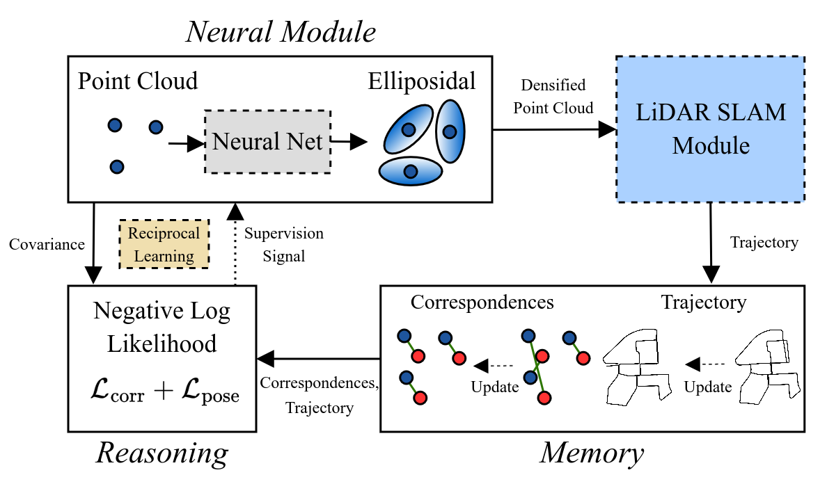
신경망이 예측한 공분산으로 점군을 증강해 SLAM에 전달합니다. 갱신된 대응점과 궤적은 메모리에 저장되고, likelihood 기반 기하 학습에 다시 사용됩니다. 이렇게 기하 추론과 SLAM을 번갈아 수행하며 추정 결과를 개선합니다.
평가
KITTI에서 LiDAR 해상도를 달리하며 odometry와 전역 정합을 평가합니다. Table I의 16채널 조건에서 300프레임 구간의 병진 RPE는 Raw의 15.55 m에서 2-step의 7.85 m로 감소합니다. 전역 정합에서는 반복 횟수가 늘어난다고 항상 더 좋아지는 것은 아니며, 학습 시간과 초기 추정 품질도 고려해야 합니다.
English summary
This framework learns local Gaussian geometry using correspondences and trajectories estimated by SLAM, without dense geometry labels or ground-truth poses. Predicted covariances support scan densification; the resulting scans improve SLAM, whose updated estimates provide supervision for another geometry-learning step.
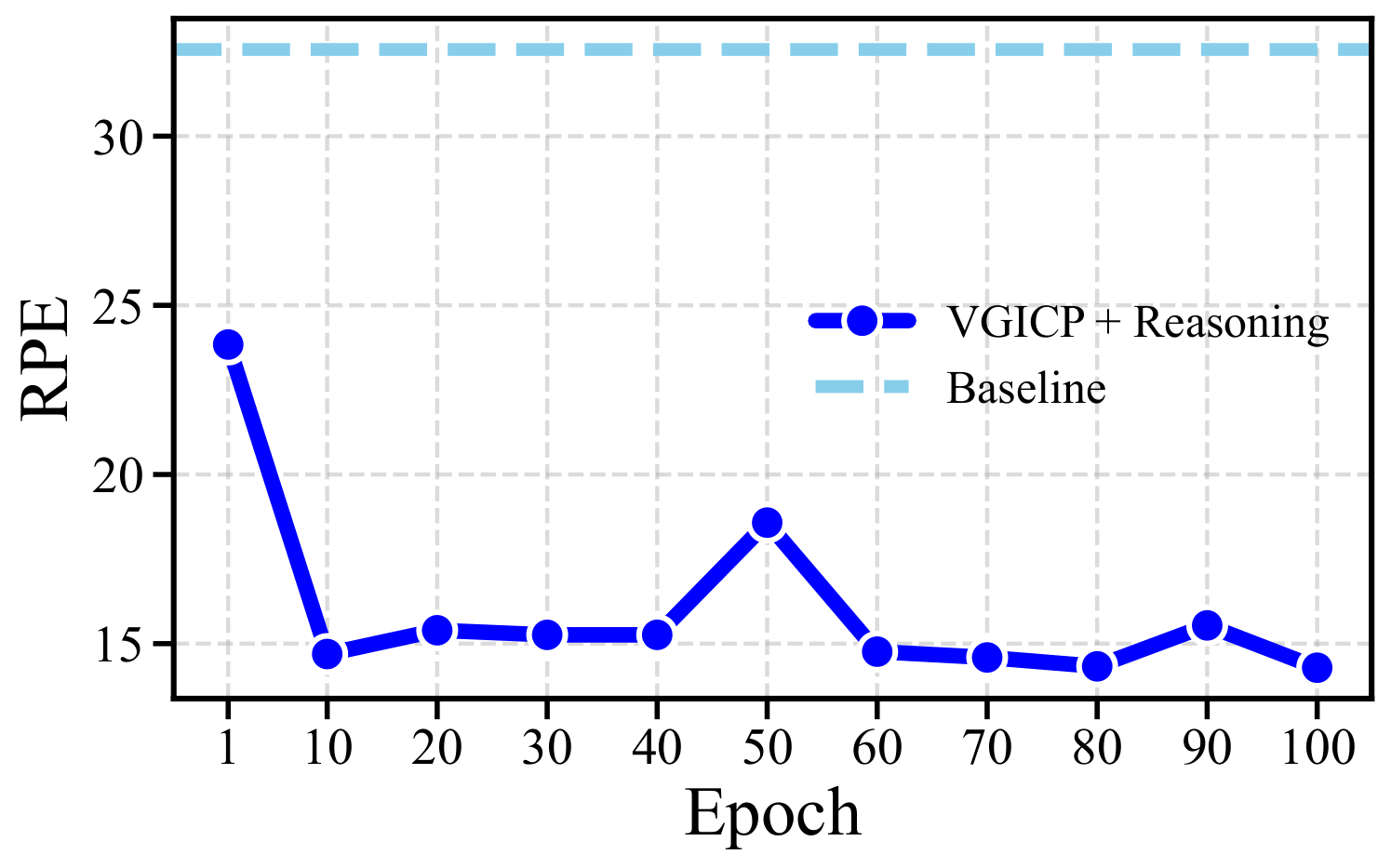
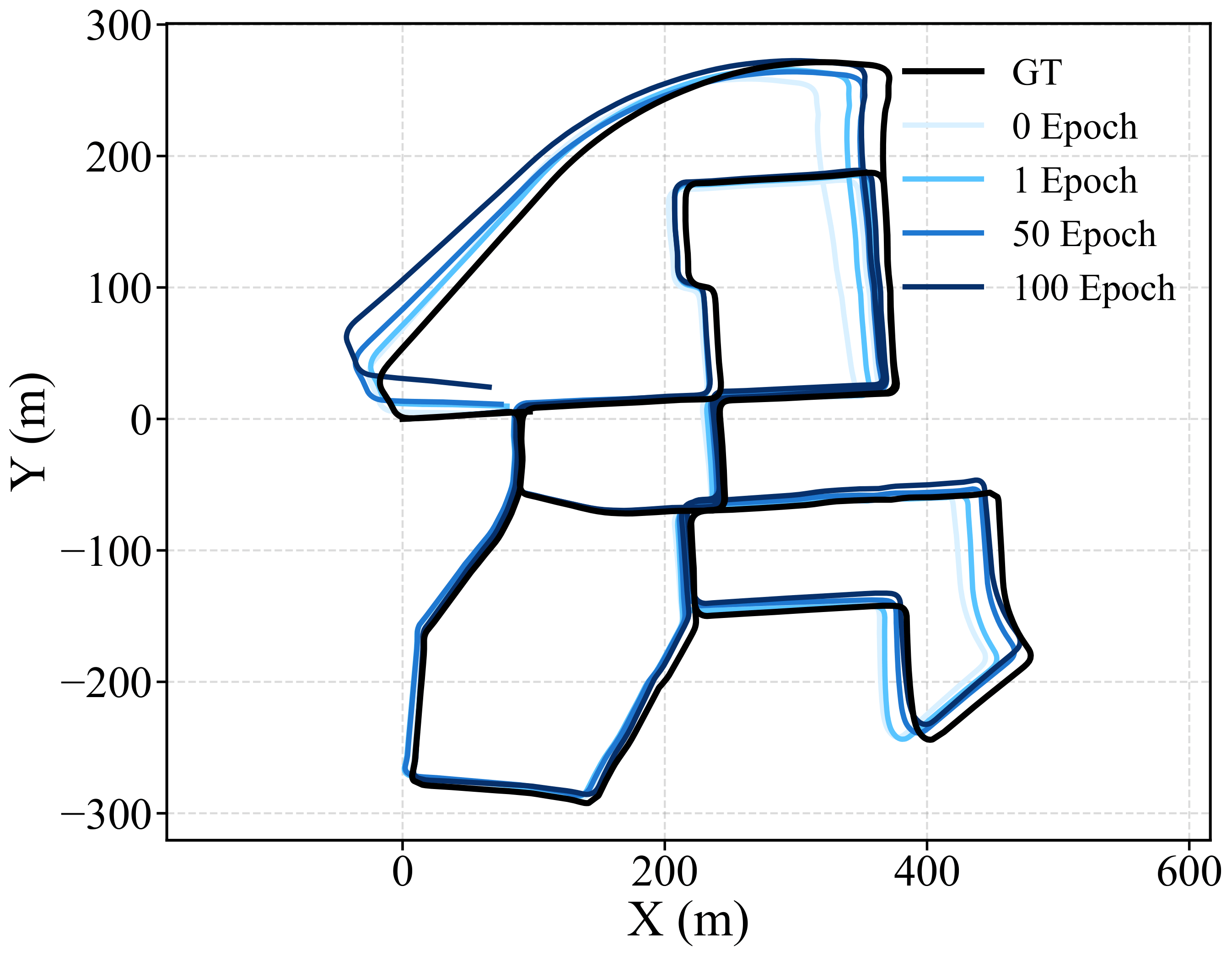
Experiments vary LiDAR resolution on KITTI. In the 16-channel setting, translational RPE over 300-frame intervals decreases from 15.55 m for raw scans to 7.85 m after two steps. Registration gains are not strictly monotonic with additional rounds, and training introduces computational overhead.
Presented at the RSS 2026 workshop From Perception to Action: Representation-Centric Robot Autonomy.
Inside the paper · 주요 Figure
Summary and figures: Kim, Lee et al., Self-supervised Geometry Reasoning for LiDAR Simultaneous Localization and Mapping, RSS Workshop 2026, arXiv v1. Original figure numbering retained. 그림을 클릭하면 원본 크기로 볼 수 있습니다.